Outdated Classifications Still Guide the Use of Hawai‘i’s Ag Lands
The valuation of agricultural lands is more than an academic exercise: It is an important factor governing land and power in Hawai‘i.
A series of land classification studies completed over 50 years ago — based on data organized before Hawai‘i became a state in 1959, including surveys from the 1930s — continue to influence the use of agricultural lands across the Hawaiian Islands.
State administrative rules, state laws and county ordinances still use the outdated land classifications to inform decisions about the siting of country clubs, farm dwellings, solar farms and even landfills.
Efforts to create new designations over the decades have failed. A state report in 2024 warned, “These legacy classifications not only obscure the true potential of Hawai‘i’s lands but also complicate efforts to adapt to modern agricultural and land development needs, representing a dramatic departure from the holistic resource management principles of the ahupua‘a system.” (tinyurl.com/hilandreport)
The latest effort to reform the system failed to pass the state Legislature this year. According to some observers, one reason may be that the issues are too abstract for some lawmakers. It’s naturally difficult to comprehend the relevance of a half-century-old study to Hawai‘i’s agricultural future.
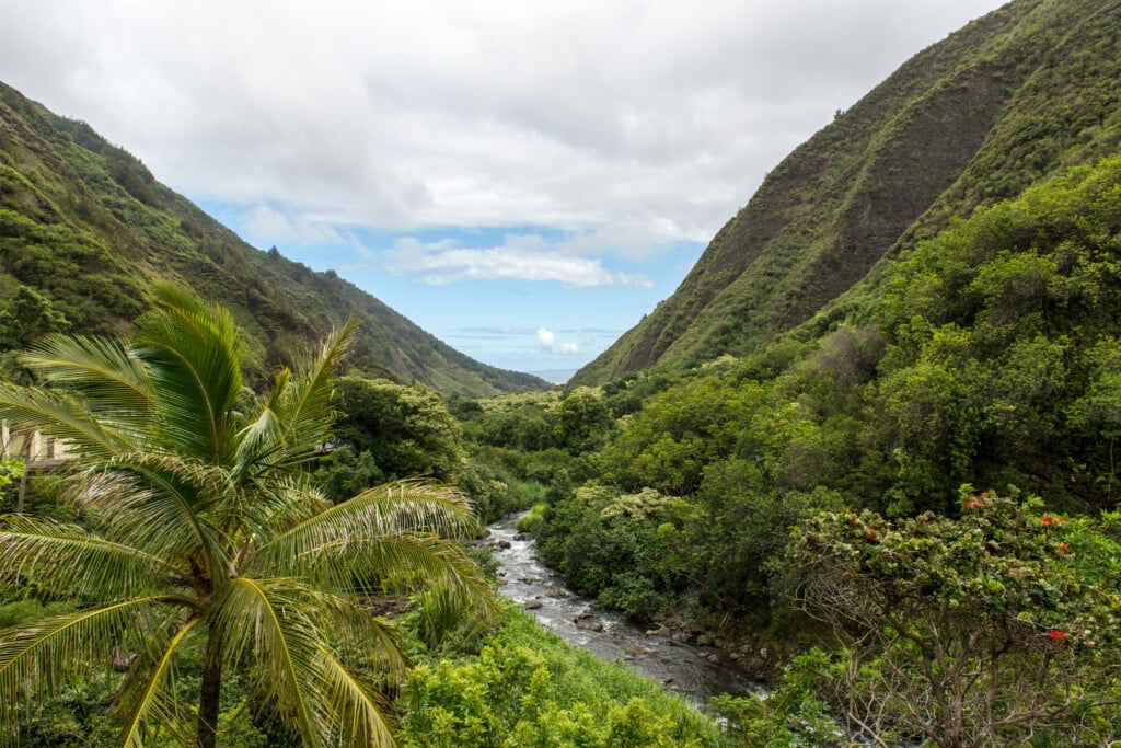
But numbers help explain why reform is so necessary. Of Hawai‘i’s total area of 4.11 million acres, approximately 47% is classified as agricultural — 1.93 million acres, according to the state’s Data Book. Yet only 120,632 acres were actually farmed for crops in 2020, the latest year for which data is available.
Designated agricultural land is everywhere in Hawai‘i. This is why the saga of the Land Study Bureau is not only a tale of a defunct government agency. It is the story of why the future of Hawai‘i’s agricultural sector is arrested by outdated metrics informed by a foreign past. Furthermore, it is a tale of what needs to be done to untether Hawai‘i’s future from an agricultural history that will never return.
The Highest and Best Use
Territorial Gov. Samuel P. King created the Land Study Bureau in 1957 to “develop, assemble, coordinate and interpret data on the characteristics and utilization of land throughout the Territory” to determine the highest and best uses of those lands.
The bureau’s five-point, alphabetical scale ranked “A” ag lands as the most productive, while “E” lands were considered least productive. Preserving high-yield, economically productive ag lands was a critical piece of the bureau’s mandate.
“It is relatively easy to convert good agricultural land to urban areas but the process can seldom be reversed,” warned a 1959 LSB report (tinyurl.com/1959report).
While the bureau’s “Overall (Master) Productivity Rating” ranked lands ostensibly based on facts and data on topography, rainfall and soil surface texture, many designations involved subjective decisions. For instance, sites reliant on extensive irrigation were classified as receiving 100% rainfall, no matter the actual precipitation.
Tomotsu Sahara, an LSB specialist in land classification, explained the association between higher land value and greater water availability during a 1969 conference on land use issues at UH. “Where there is a moisture deficiency and irrigation water is not available,” Sahara explained, “the land types are rated lower than if adequate moisture were available. If to this land water were applied, it would be given a higher productivity rating.” (tinyurl.com/Irrigateland) Decades later, the designations remain, regardless of whether the irrigation systems are still being used or have fallen into disrepair or disuse.
“It’s a snapshot of a particular era’s irrigation,” explains Hunter Heaivilin, a local food systems planner who oversaw the drafting of the legislatively mandated report in 2024. Whether or not land was irrigated for sugar or left unirrigated (as was the case with pineapple) would have long-range consequences. “The legacy of global market forces mediated through crop decisions and thus, irrigation, became enshrined in our policy for over half a century,” he says.
The nationally renowned planning firm Harland Bartholomew & Associates was hired to work with the Land Study Bureau; it produced recommendations in 1961 concerning implementation of the state’s land use law. (tinyurl.com/1959report)
The law remains in effect, dividing the state’s lands into four critical zoning areas: (1) urban; (2) rural; (3) agricultural; and (4) conservation. These zoning designations supersede county zoning authority.
The 2024 state report concluded, “Most remarkably, soil data collected in the 1930s, released in the 1950s, and incorporated into Land Study Bureau ratings in the 1960s continues to govern critical land use decisions – such as where solar energy projects will be established on agricultural lands in the 2030s.”
As plantations declined and agricultural trends shifted, the relevance of the Land Study Bureau’s reports came into question. But the LSB was closed before it could re-evaluate its methods: In 1973, the state budget effectively abolished the bureau, although the budget bill itself did not explicitly say why. Instead, it fell to House Standing Committee Report 732 to make a single note of the LSB’s deletion from the state budget, rationalizing that “this is what should be done when programs cease to be of high priority in terms of university or State needs.”
Meanwhile, then Gov. George Ariyoshi used LSB classifications to limit the “permissible uses” of agricultural lands in 1976. And though their applicability to real-world debates over the future of agricultural lands are inadequate, the bureau’s classifications continue to influence land use decisions today.
How Did We Get to This Point?
In the decades after the publication of the Land Study Bureau’s last findings in 1973, Hawai‘i’s political institutions struggled to create a universal classification system for managing agricultural lands.
The LSB’s thorough findings were supposed to inform a transparent process. “As many planners have discovered, however, the material is too academic in some respects and too difficult to apply in others to be useful as a guide for specific questions of conservation or development or for political administrative judgment between the two,” planner Thomas Creighton said in 1978.
Alternative systems of assessing agricultural land have been proposed. In 1977, the state Board of Agriculture adopted a broader, more expansive mechanism for designating “prime” agricultural lands. In 1978, the Hawai‘i Constitutional Convention adopted an amendment to “conserve and protect agricultural lands, promote diversified agriculture, increase agricultural self-sufficiency and assure the availability of agriculturally suitable lands.” The Constitution mandated that the Legislature would be responsible for providing “standards and criteria” to accomplish these goals.
The Land Evaluation and Site Assessment Commission, established by Ariyoshi in 1983, finalized the mechanics of a proposed system in 1986. Nevertheless, the Legislature refused to adopt the system, rendering the work worthless. It wasn’t until 2005 that a state law created the Important Agricultural Lands (IAL) designation. According to Earl Yamamoto, a planner with the Hawai‘i Department of Agriculture, LSB data can influence the designation of IAL parcels by the State Land Use Commission.
Meanwhile, the LSB classification system continues to govern permissible uses on all state agricultural lands. As of 2024, permissible uses of agricultural lands have been expanded through amendments 25 times.
The LSB’s land classification process “was a one shot deal. It hadn’t been updated,” says Aaron Setogawa, acting branch chief of the state’s Land Use Division. “There was no means to update the [LSB] system. There was no means to challenge or effectuate changes in it because it was just a study. It was a snapshot in time.”
Setogawa is a major proponent of the 2024 state report, the latest attempt to reform the LSB classification system.
The reform effort began with state Sen. Lorraine Inouye, a longtime advocate for farmers who represents Hilo, Pauka‘a, Pāpa‘ikou and Pepe‘ekeo on the east side of Hawai‘i Island. During the 2022 session, she introduced Senate Bill 2056, which formally pushed for an updated land classification system. The bill passed and was signed into law as Act 189 by Gov. David Ige.
So 50 years after the last LSB studies were furnished, the state Office of Planning and Sustainable Development was tasked with determining whether the studies were still relevant. As Setogawa coordinated the preparation of Act 189’s final report, these were the questions that he pondered: “What is the history? How did we get to this point? What are ways to improve [the system]?”
Stakeholders like UH’s College of Tropical Agriculture and Human Resilience, the state Department of Agriculture, the Hawai‘i Farm Bureau, Hawai‘i Farmers Union United, and even the Hawai‘i State Energy Office supported the measure.
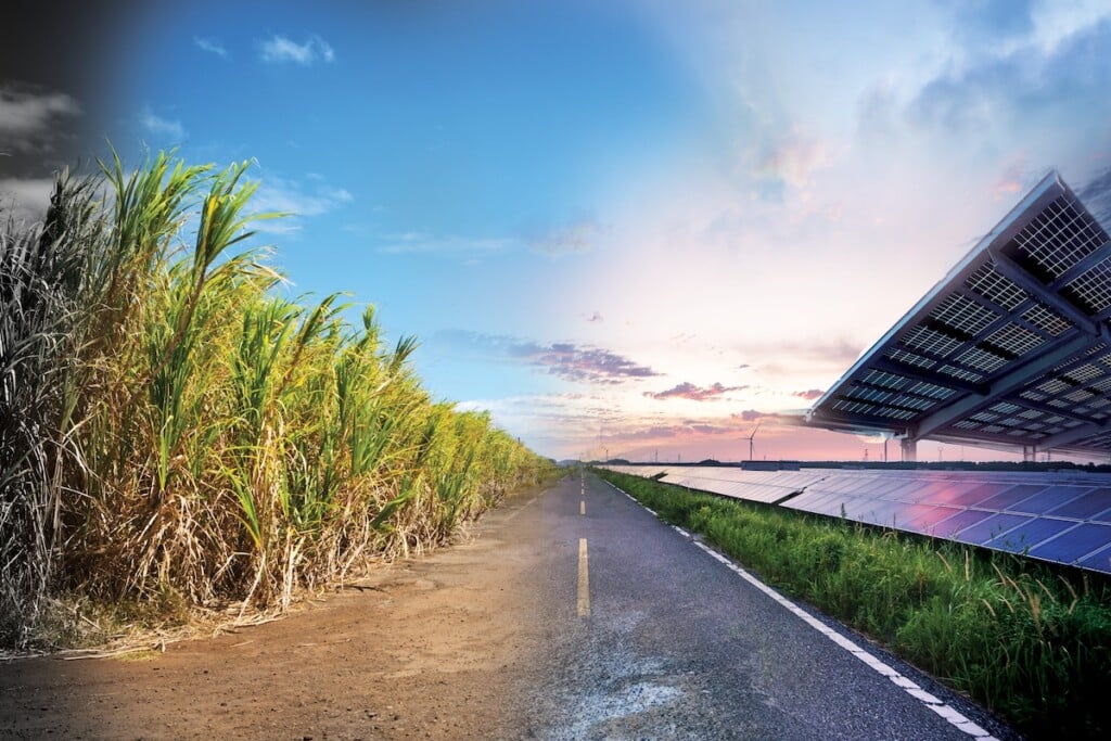
“Soil classification is no longer the determinant of land good for agriculture,” explains Hawai‘i Farm Bureau Executive Director Brian Miyamoto. “Greenhouses, hydroponics, aquaculture and aquaponics are just a few of the many types of agriculture that can occur on all classes of land (A, B, C, D, E). Some of the best floriculture and hydroponic operations in Hawai‘i are on C, D, and E lands.” Some of these technologies and uses contrast starkly with agriculture in the 1950s and 1960s when the Land Study Bureau devised the classifications.
Solar farms are a prominent example. Beginning in 2008, solar farms were permitted on poorly rated agricultural lands. By 2011, legislation expanded solar’s reach to include higher-rated agricultural lands.
A study found that the land’s classification was still based on whether it had been irrigated for sugar or nonirrigated for pineapple. Scott Glenn, then the state’s chief energy officer, explained: “For example, although the soils in one area may have a productivity rating that is higher than another area, the availability or lack of irrigation water may encourage or constrain the actual productivities of the various sites. The degree to which these factors are captured [or not] in the current system deserves review.”
For two years after the passage of SB 2056, the Office of Planning and Sustainable Development met with stakeholders. Focus groups convened experts on technical legal matters, agriculture, land use, energy, development and large landownership across Hawai‘i’s four counties, with representation from the farming community, state and county government, nonprofits and others.
After over two years of community engagement, research and discussion, the Office of Planning and Sustainable Development presented its final report to the Legislature at the end of 2024. It recommended a new, uniform land classification system for all of Hawai‘i.
What’s the Next Step?
At the Land Use Commission meeting of Jan. 22, 2025, Chair Dan Giovanni asked the key question, “What’s the next step?”
Gov. Josh Green’s administration pushed for the introduction of House Bill 1012 and Senate Bill 1331 as mechanisms to update the soil classification system. HB 1012 never received a hearing and SB 1331 only got one – from Inouye, chair of the Senate Committee on Water and Land. She described the legislation as “long overdue.” (tinyurl.com/1331hearing)
Nevertheless, the bill did not pass. Observers say legislators’ lack of understanding about the issue was a major obstacle. “Confusion abounds,” says food systems planner Heaivilin. “I think the nerdiness of the issue is literally underfoot, and the wonkiness of it makes it difficult to get public support.”
The report concludes, “The LSB model should be updated to a dynamic, statewide system that retains the familiar LSB title and A to E output classes. By maintaining the familiar LSB framework while updating its underlying data and methodologies, disruption to existing policies and statutes can be minimized while significantly improving the accuracy and relevance of the system.”
The report also says the new framework must integrate historical and current land use practices. And the Legislature needs to authorize a routine review of existing maps and models. Once a new land classification system is set, state and county laws permeated with outdated classifications can be revised.
This work could bear serious consequences in future efforts to identify and designate IAL parcels across Hawai‘i. “The LSB, for now, and its successor, should be the foundation upon which future ‘conversations’ about [agricultural] land use begin from,” Yamamoto explains. “And this foundation should be as sound as the original LSB work.”
The U.S. Department of Agriculture’s Natural Resources Conservation Service was identified as a source of reliable data to replace older data. Since January 2025, however, the agency has faced staff reductions and threatened budget cuts.
Land classification systems, while intended to inform future decisions, far too often reflect the political frameworks of the past.
“It’s not really about soil types,” says Hugh Starr, a longtime agricultural land analyst, ranch consultant, agricultural real estate agent and ranch hand. “It’s about culture. It’s about half of our land being in the agricultural designation. We’ve created a social paradigm that’s got nothing to do with soil.
“We were placed in this paradigm by politicians in the ’60s throwing everything into the agricultural designation as though that was the wand of God and said, ‘This land is inviolate.’”